First we'll need a map of the city and then eventually, the Realm. I know Demie has been commissioned to draw up a map or visage of the city. Post what you can Demie and lets the rest of us throw up some ideas to flesh it out.
We need this for story idea's, game idea's, etc, etc,
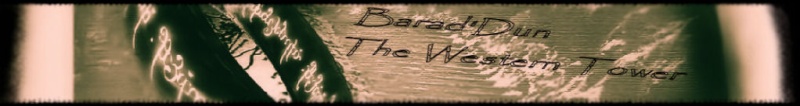
So for those who have read the Official History of Barad'Dun and the "Outpost 7" storyline, lets see what we have so far...
First of All, the thing that attracted the original Sailors to the site was its beautiful harbor. for ancient mariners harbors were an area of sand or gravel (that they could pull their ship out of the water on) protected from the sea by rocky promotories. In our case one promotory was a cliff of Obsidian like rock to which they later built the tower on. The other side of the harbor would have been protected by a jutting rocky promotory (perfect for a lighthouse) or a manmade jetty of rock.
so you naturally have a harbor area that will eventually lead to some beach, which in the old days was not for swimming but for fishermen to pull up their boats on, while other parts of the harbor would be built up with wooden or stone piers for merchants to tie up their ships and unload/load cargo. Here we would have merchant warehouses and perhaps a fish market. There would be the harbor master's house and some guard keeps. You might also have a military pier which would be like fenced off and might contain roofed ship houses and open piers with long ships (Or Kilanos Waverunner)
You have the Tower built on the Obsidian clifftop with a bridge going over the "Orcchasm". around the base of the Tower area would be the Administrative heart of the city, with the King's quarters, his Officers, the Archives section, churches/temples, etc, Area's with statues for past kings, and battle monuments. The cities treasury would be housed here, possibly the barracks of whatever force (The Tower guard and Royal Guard) that protect the King and police the city. The city's armoury might be located in this area too. The tomb of Barathor is here.
In between the Harbor and the Tower Districts would be an area bustling with merchants and taverns, probably the city market as well. (Name for this district?)
Near the Tower district would be a "rich people" district with beautiful stone houses and lush walkways, parks, ponds, etc, where the well to do live, rich merchants, etc. (Name)
Two areas named in the Official History are the Blood Hills district and the Hadash.
The Blood Hills district are based to the North West and are more rocky and hilly with blood red hills. This area has been settled by mostly dwarves and humans as well as goblins/gnomes, etc any creature at home in a hilly environment. Taverns, workshops, smithies, and the like are in this area.
The Hadash is the dark heart of the city. Twisted narrow alleys', shops of all kinds, Taverns with shady proprieters and even shadier denizens, The red light district (bordellos) the Bazaar market where anything goes, Home of the secretive Dragon Cult. A police barracks near the rim of the district but the police force (City Guards) only patrol during the day. At night, its lawless and the bodies are collected in the morning and taken to the great cemetary outside the city walls where tombs of the rich lay next to crypts or graves of the poor.
You would have a working class area, some shops, some taverns, schools, Some kind of nunnery where the sick are cared for. Family housing, crammed together, not as dingy or shady as the Hadash.(Name)
You would have the middle income people's district. More open, but less oppulant houses than that of the rich quarter. (Name?)
A military district which not only houses the Royal Army compound, but several compounds for Mercenary units and barracks for free mercenaries. There are tavern's and shops that cater to this crowd. Another armoury. Food storage for the city might be in this area and warehouses which merchants might build thinking things are safer in the military district.
The city is surrounded by thick walls of the amber/gold stone the tower is made out of. Every so many feet is a square tower with arrow loops.
Several Strong Gates are built into this wall allowing caravan's of merchants to travel freely in and out of the city. The gates have strong iron portcullis, and flanked by guard towers. How many roads in and out of the city? Probably 3 major ones, North Road, West Road and South Road. There would also be at least two secret sally doors hidden next to towers.
Ditch or moat around city?
Beyond the walls would be a few shanty towns of poor folk, narrow and shady just like the Hadash. Also farmers and herders growing saleable foodstuff for the city. An outpost might be on each road a little bit from the city as well as a few inns providing travelers with security, rest and food/drink.
Rivers, How many rivers flow into the city to the sea? At least one or two should be neccessary for the live of the city. Here's fresh water and also a conduit for sewage, though the founding fathers both of Numenorean and hired Elf archetects did construct a beautiful underground sewage system of brick and stone.
I beleive, if memory serves, there is a sacred spot with a tree planted by the original Numenorean sailors, or a wooden marking post. This would be near the harbor and would undoubtbly be the city's most sacred spot. Guarded by a Tower Guard Detachment, or would that be flower guard detachment?
Other idea's? Throw up some rough sketches too, lets brainstorm it out.
Konradr